If Ipswich is proposed to be anything like Parramatta then they could have their own light rail network connecting Ipswich to Springfield and beyond.
Sounds fine to me. Grade separation is good in heavily built-up areas like a second CBD. That’s what Ipswich is capable of becoming for greater Brisbane, if the government wants to provide the infrastructure to allow it to happen.
It depends on what the future population and demand for service is going to be. I’m sure there was an analysis back in the 1990s that said the South East Busway would not run into capacity issues within 15 years of opening, but it did. It’s entirely possible that as Ipswich grows, buses running on surface roads (some of which will not have the space for widening into a transitway) will not be enough to keep up with demand.
Remember that a transport corridor isn’t just for the next five years or even the next 25 years, it’s something that can potentially last for centuries if continually maintained. Our other railway lines aren’t going anywhere, nor will this if built. The higher the capacity, the better it can deal with future growth without needing reconfiguration.
I hope we can agree that urban sprawl beyond 40-50km is bad development and should be discouraged. So if we’re presented with a potentially negative outcome, why would we not do what we can to stop that happening? If I’m driving and I’m in a situation where I have an 85% chance of a collision, but there’s a manoeuvre I can do that reduces the chance to 80%, why wouldn’t I do that?
But that’s not relevant, because you’re suggesting to abandon any prospect of the line continuing north from there in future so that we can maybe serve yet more urban sprawl even further away from the Brisbane CBD. Yes, we don’t agree on where the line should go after Deebing Heights.
1 Like
Development and associated population growth does not just happen organically. It is and can be controlled by city plans. Just because those city plans enforce car-dependent sprawl at the moment doesn’t meant they have to. Build the right infrastructure then plan around it. Planning 101.
1 Like
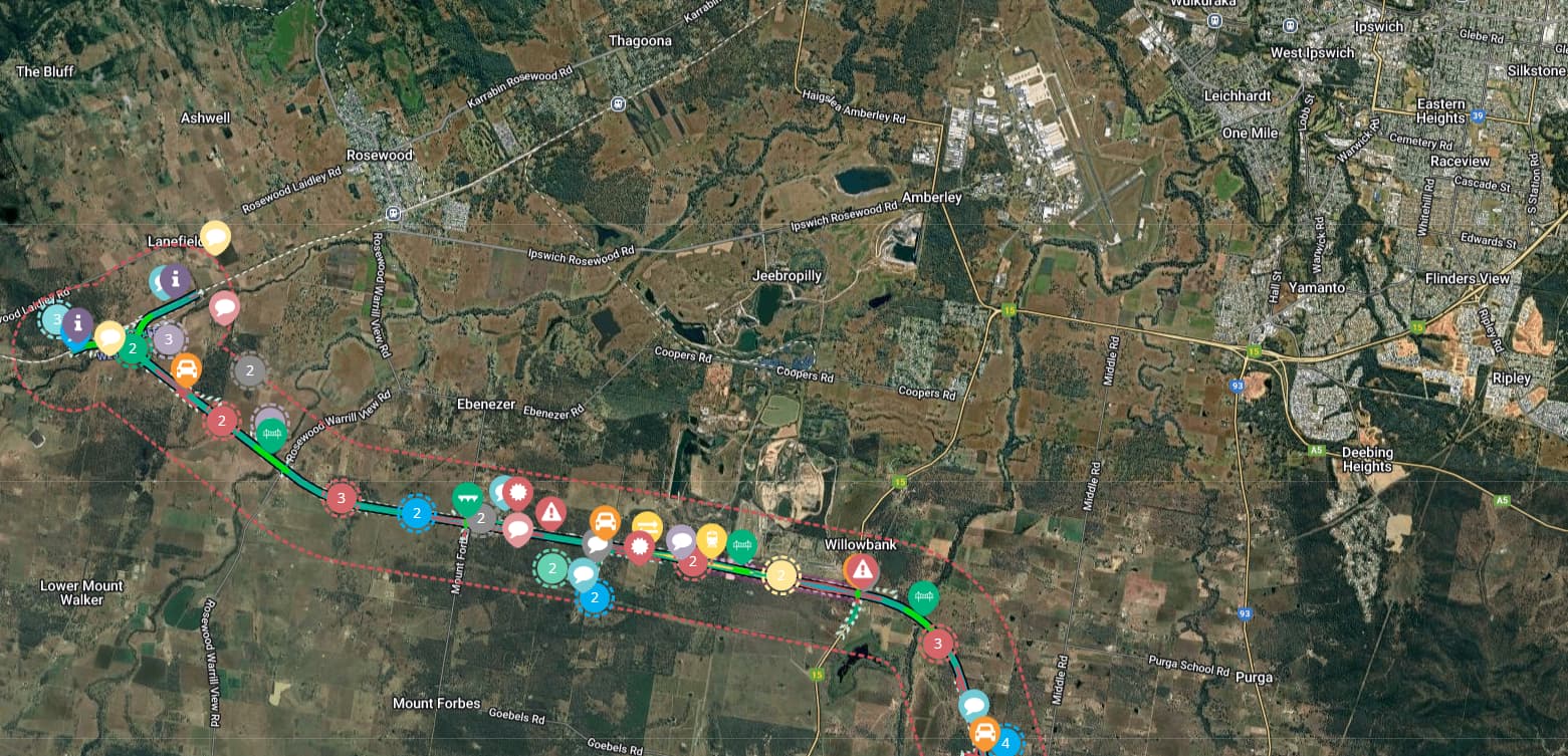
As mentioned, there are several expensive and time consuming challenges associated with extending rail into Ipswich due to the necessity of trains to operate within a Priority A corridor. The distance between Ipswich and Deebing Heights is about 8.5 km and traverses an already built up area.
Extension of the Springfield line into Ipswich (and engaging the challenges associated with it) is not required for the forseeable future when a frequent connecting bus can be run off the end of the line at Deebing Heights station (or whatever the train terminus station eventually becomes).
If yamato to ippy too cost prohibitive
Suggest look into rosewood to yamato via ebenzer as i think a section of it already planned for inland rail, yeah?
1 Like
@Windy For your reference: Calvert to Kagaru April 2019 | Social Pinpoint
4 Likes
This is restating the same point that I’ve already responded to above.
I could argue this for every single prospective rail line really. It’s the sort of thinking that leads to a half-built Maroochydore line and the rest being busway. I’m all for a bus using surface roads to make the link to begin with, but why build in a lower-capacity mode and force everyone to transfer when it could just be built once and last for a century without needing to go back in and upgrade it later at great expense and inconvenience?
4 Likes
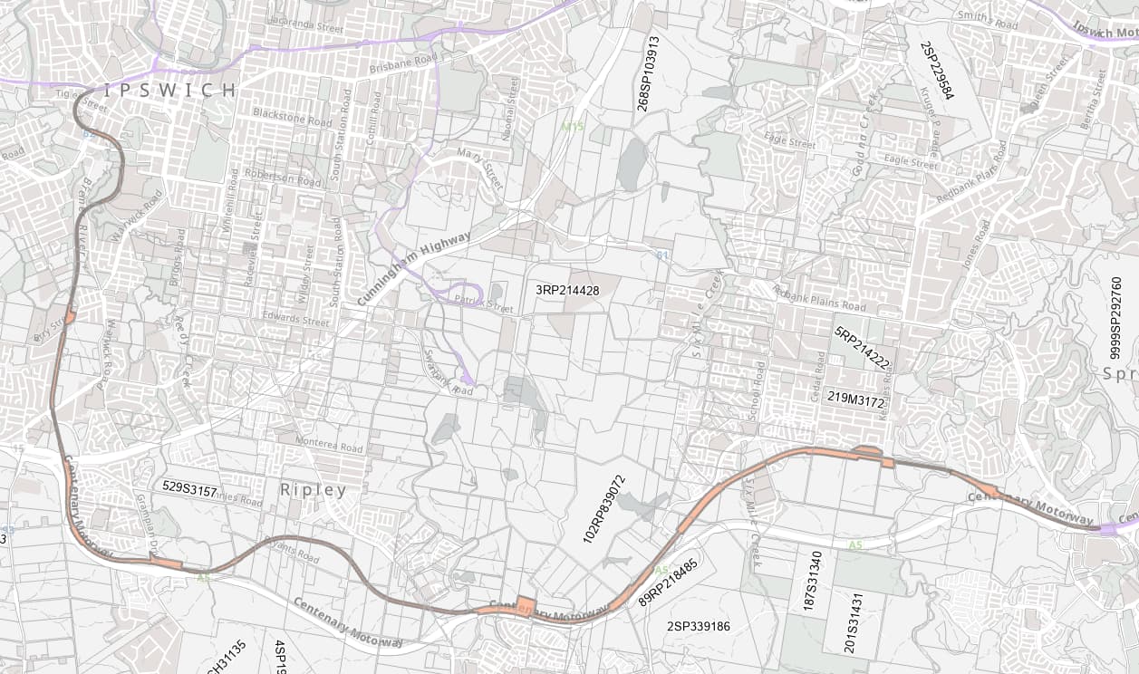
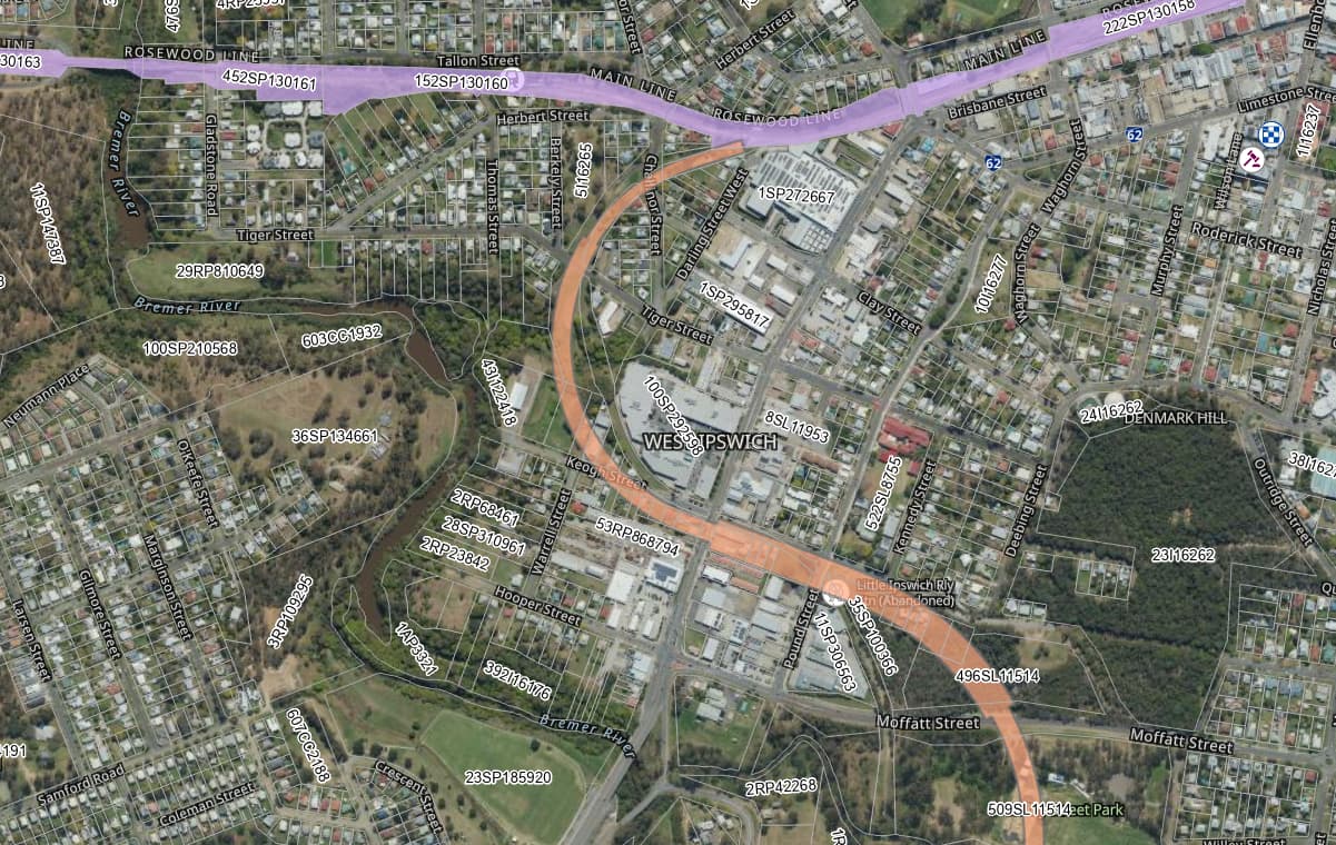
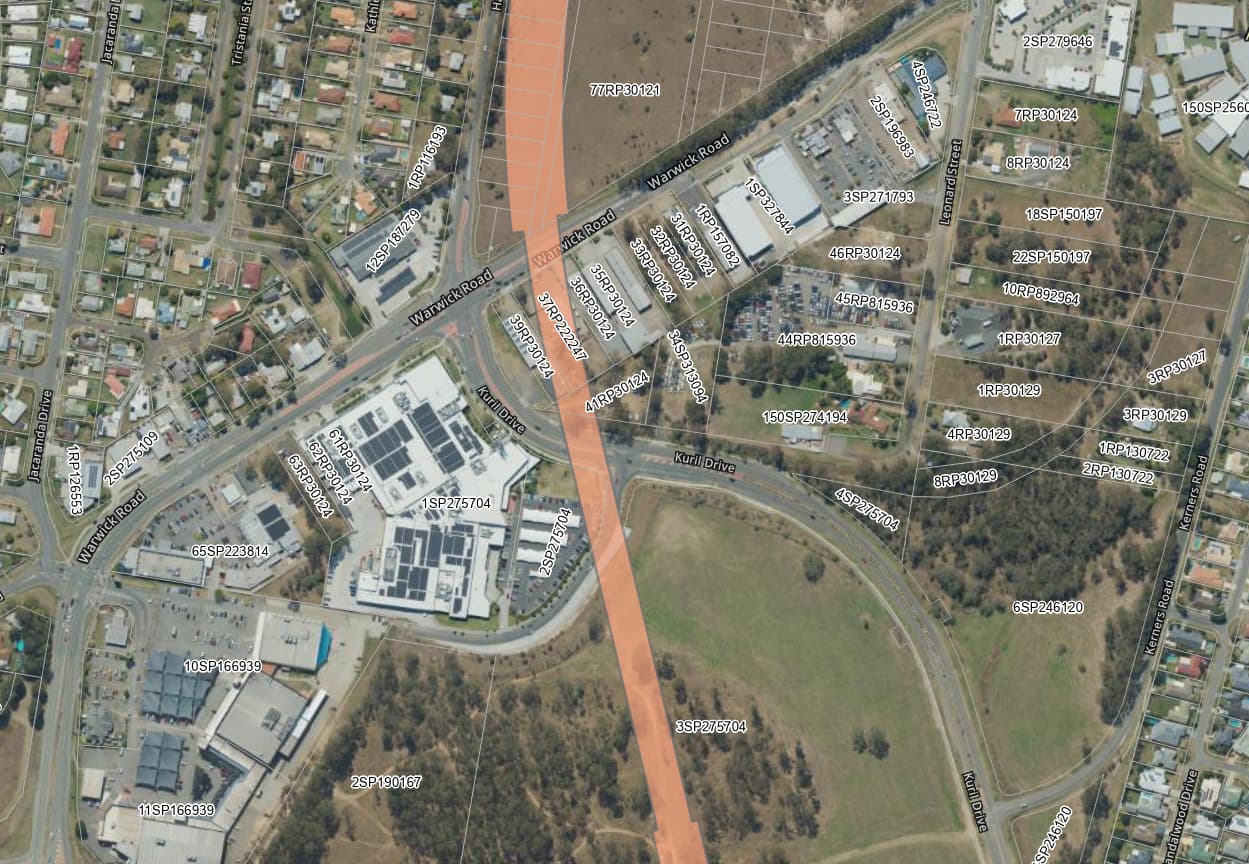
@Metro I don’t even know where you got the idea that the corridor is fully built out between Yamanto and Ipswich anyway. The earmarked corridor follows the old Dungadan railway line, which is still partly visible on maps, and you can see it clearly when you walk through the area. From memory it’s mostly gravel paths now, and I think the only part that’s been built over along the alignment is near the Hungry jacks at Yamanto and an industrial property on Keogh street.
It’s not wide enough for a modern double track railway, but it would be wide enough for a viaduct pillar, which is what I always imagined the plan was, given part of the corridor is over the Bremer river, and it crosses numerous streets in West Ipswich
5 Likes
The corridor is protected by TMR and is shown on the DA Mapping System. It’s also shown in the new Ipswich Planning Scheme.
You can also see where it runs through Redbank Plains because a gap had been left between the developments.
4 Likes
Well, because a bus is likely to be sufficient for the forseeable future.
This is pretty cool, thanks for posting. What does the end closer to Ipswich look like?
1 Like
1 Like
I replied above with Ipswich West and Yomanto, but you can have a look at the whole thing on the Development Application Mapping System here: Mapping | Planning
Transport Infrastructure is under SARA Mapping in the menu, and it shows corridors that TMR have gazetted for future road, rail, light rail and busway (in addition to current ones and planned upgrades that are at corridor protection but not necessarily gazetted).
3 Likes
Thanks for posting these!
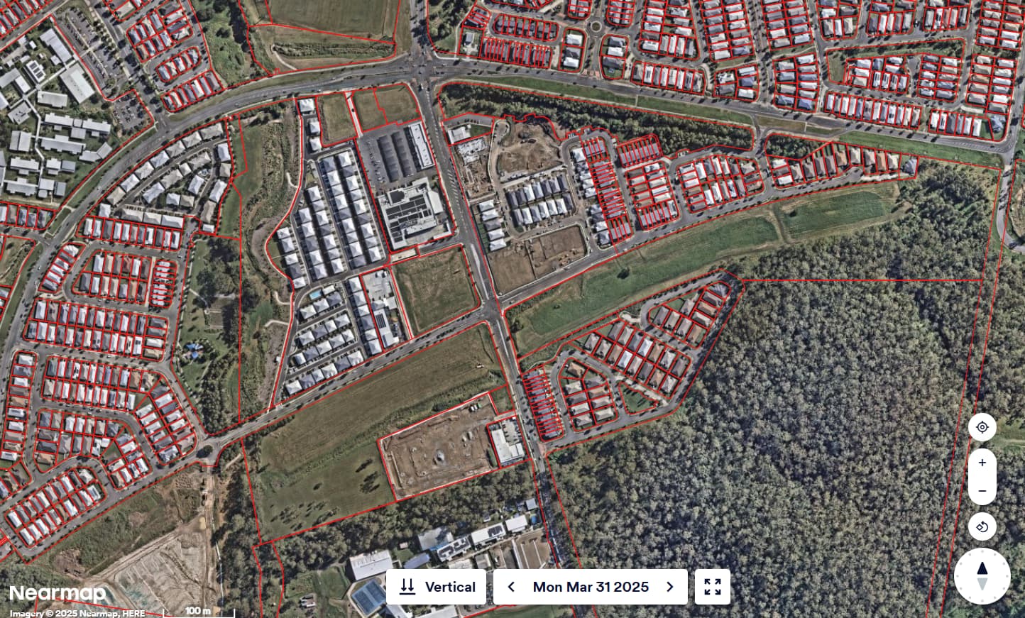
Honestly the extension to School road is so simple, I’m bothered they haven’t done it sooner. Springfield line isn’t really capacity constrained, CRR won’t really do anything to improve it so aside from rollingstock and simple political willpower, I see no reason why that extension couldn’t be built straight away.
It’s relatively flat, over a wide, protected, greenfield corridor, into a rapidly growing area poorly served by existing transport. And the Springfield park n ride is packed.
3 Likes
Thanks for posting this, the mapping is a great resource ![]()
1 Like
Said no city ever that has a great legible and easy to get around public transport system.
This thinking is as mind boggling as more road tunnels!!!
4 Likes
Brisbane is fairly unique in its reliance on buses to carry a lot of weight for transport - particularly given the size of the city and the SEQ region. There’s a reason why there aren’t many examples of this around the world - it’s not the best solution.
2 Likes
Well, rail in SEQ is very expensive, and even existing rail lines aren’t being fully completed. Why would this project be an exception to this known pattern?
Its not ideal, but IMHO its the most probable outcome here.
Just a thought. If (once) they build the Springfield line extension through Ripley to Ipswich, will it be quicker to take the Springfield line to Ipswich than the Ipswich line, if travelling from Brisbane? Or if Ipswich trains run express through Milton-Darra with limited stops, would it be faster from Darra?
I imagine the new line would be designed with higher track speeds and will have fewer stops.
EDIT: nevermind. Darra-Ipswich is only 30 minutes and Darra-Springfield is already 13 minutes, so it wouldn’t be competitive.
1 Like
Hence the need for clockwise vs anticlose for all stops on the ipswich lines while still have faster express line to Rosewood, Toowoomba once it opens when inland rail gets their stuff together