I didn’t see this mentioned, but the Translink notice is here: South East Busway extension and new Rochedale station and park ‘n’ ride | Translink
Lott posted a link a few posts up, but thanks all the same. ![]()
Don’t hate buses one bit!
What I do hate, and make no apology for it, is buses trying to do the job where rail based system capacity is needed to get us off worst practice mode share! It’s like trying to employ an Olympic pool with a tea spoon. Wrong tool.
I also unreservedly hate park n ride in urban settings!
2 Likes
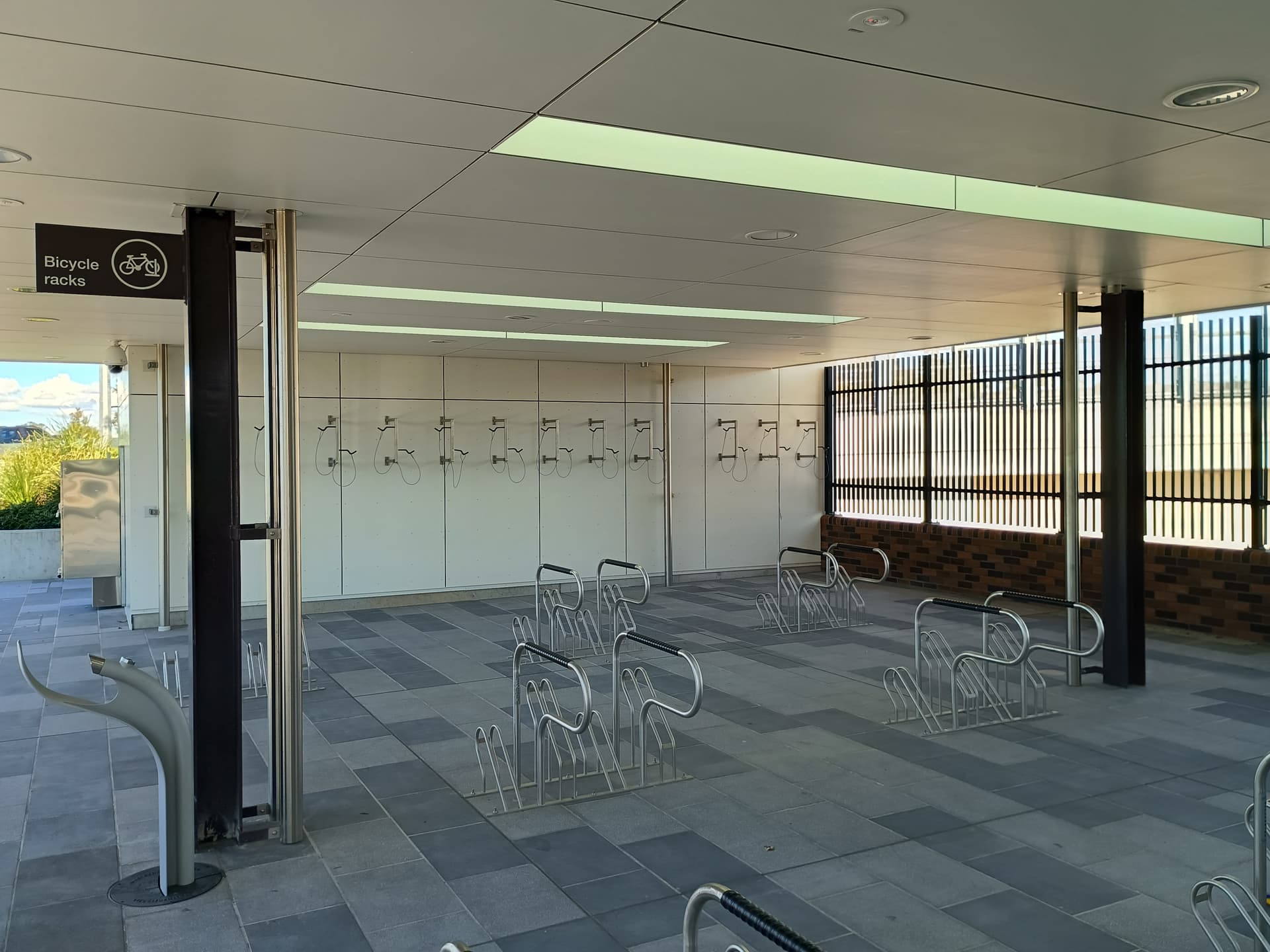
Disappointed with the lack of security for bike storage. I know QR’s bike lockers aren’t the most attractive thing, but at least I can rely on my bike being there when I return. No way I’d be leaving my bike in the open like that. Doesn’t take long with a battery-powered angle grinder to get through most locks.
https://danielbowen.com/2025/06/25/brisbanes-busways/
Brisbane’s busways
Some thoughts on Australia’s biggest Bus Rapid Transit deployment
Wed 25 June 2025
If you’ve been following my Brisbane holiday blogs, you’d know we caught a few buses.
Brisbane once had a big tram network. They were all replaced by buses in the 1960s.
By 1988 they’d built the CBD Queen Street Bus Station, with many routes diverting under Queen Street and other city streets to skip traffic.
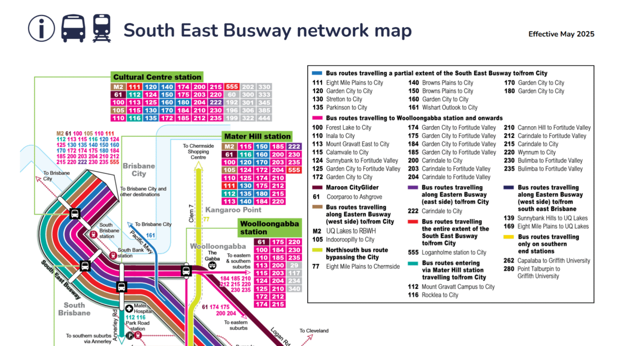
In the 1990s they went all in on busways, with the network steadily expanding. It’s now 27 km long, with busways heading from the CBD to the north and south-east, with a major branch to the University of Queensland.
I’d describe them as bus-only freeways, a way for the bus to travel along, completely separate from other traffic.
On one level it’s kind of curious that they built the busways, given like most Australian capital cities they’ve also got a pretty big suburban rail network. The busways came about thanks to strong advocacy from Brisbane City Council.
Arguably the busways have come at the expense of the rail network – for its size, it’s underutilised and the service underwhelming, mostly half-hourly frequencies, which is worse than Melbourne at most times.
Busways undoubtedly have some advantages:
- buses can bypass traffic congestion hotspots, particularly in the inner city
- the busways also serve as a limited stops routes, similar to trains, with stations every few kilometres, speeding up the trip from the outer suburbs
- the buses can also run on normal streets, so they can provide a one seat ride into areas where a high capacity mode is not practical and/or warranted – in Brisbane’s case this includes a lot of less frequent suburban routes that use the busways on the inner city sections.
- multiple routes can combine along the busway to provide high frequency/high capacity on the inner section
- the infrastructure can provide a higher quality passenger experience than regular bus stops, with large sheltered waiting areas, good lighting, and good pedestrian access into nearby traffic generators
But their are some down sides as well.
- capacity has its limits, as Brisbane is finding (see below). In fact they’re having to change to busway trunk routes plus interchange to/from local routes, reduce bus congestion in key parts of the network. This means a loss of the one seat ride advantage for some people.
- for the number of people moved, it’s very labour-intensive – even compared to Brisbane’s two-person crew trains
- ride quality on buses is never as good as rail, and my personal view is it’s fine for short trips but some people (myself included, if I’m honest) are less enthusiastic about long trips – eg a city to middle/outer suburb commute
- I do wonder about cost of busways compared to light rail, though it doesn’t have all the same benefits
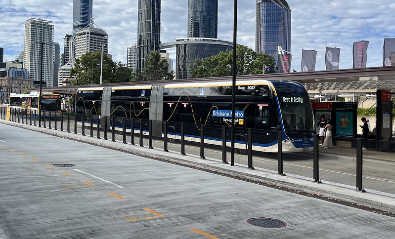
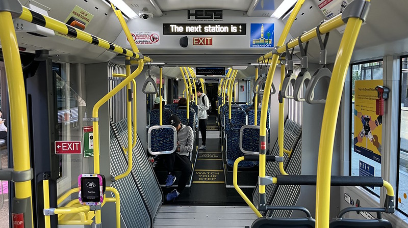
Apart from route changes, they’re also trying to counter capacity issues with the introduction of “Brisbane Metro”, high capacity electric buses along the busiest routes.
We got to ride the M2 route, and it’s pretty good. Inside it looks like a tram, and it’s got good acceleration and speed. Ride quality is still not up to rail though.
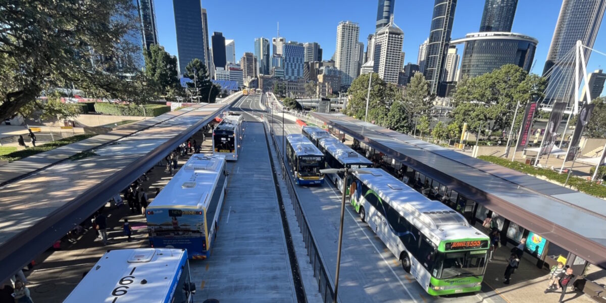
Cultural Centre
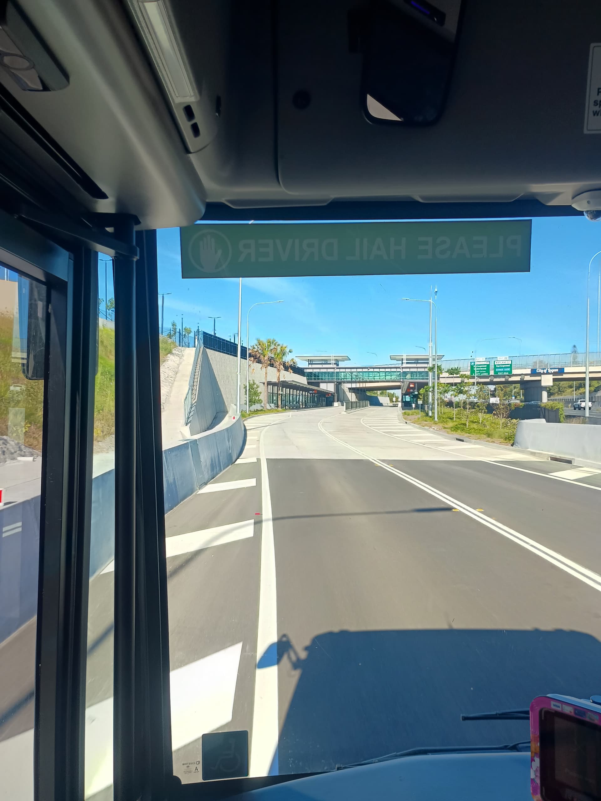
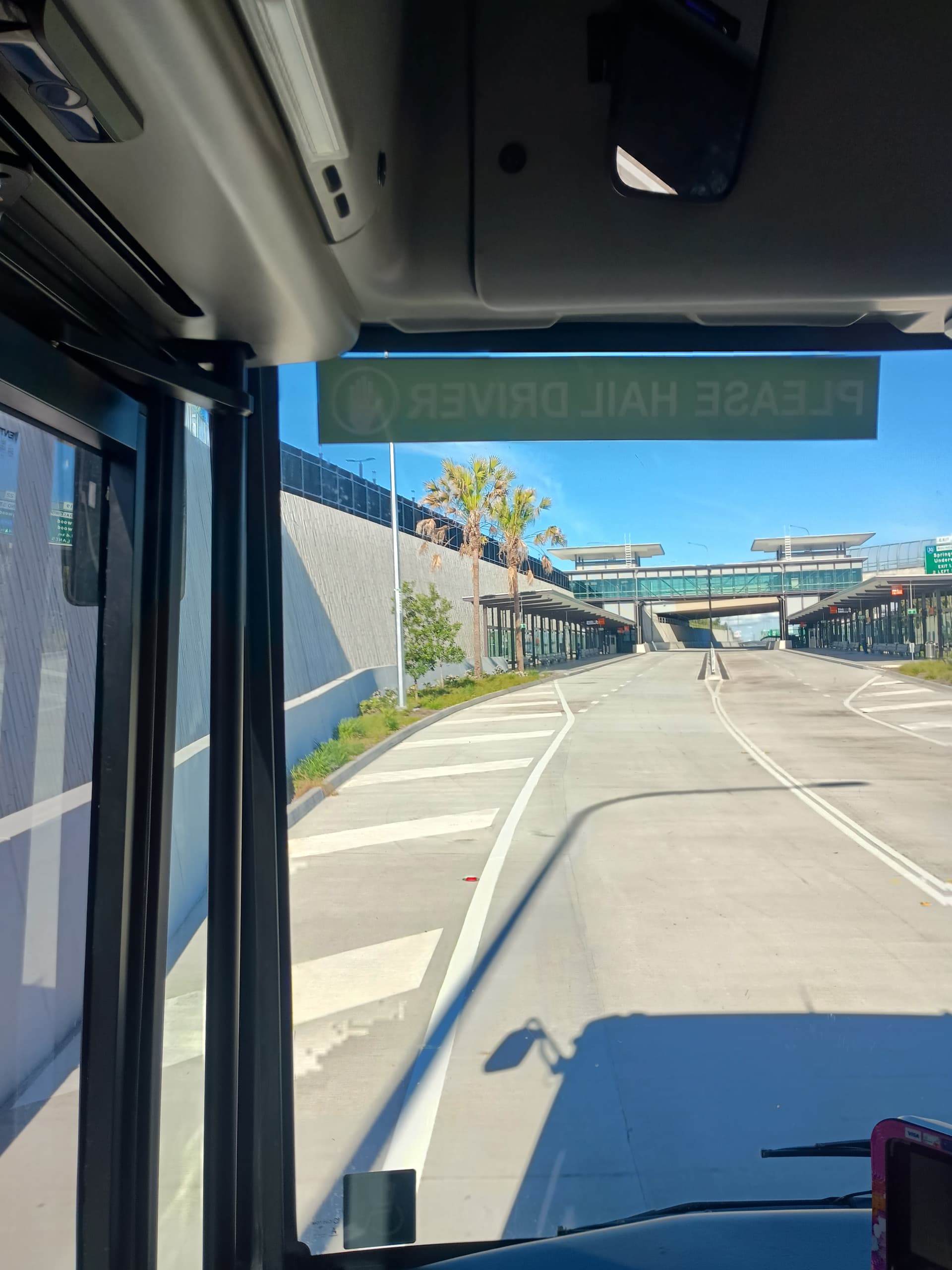
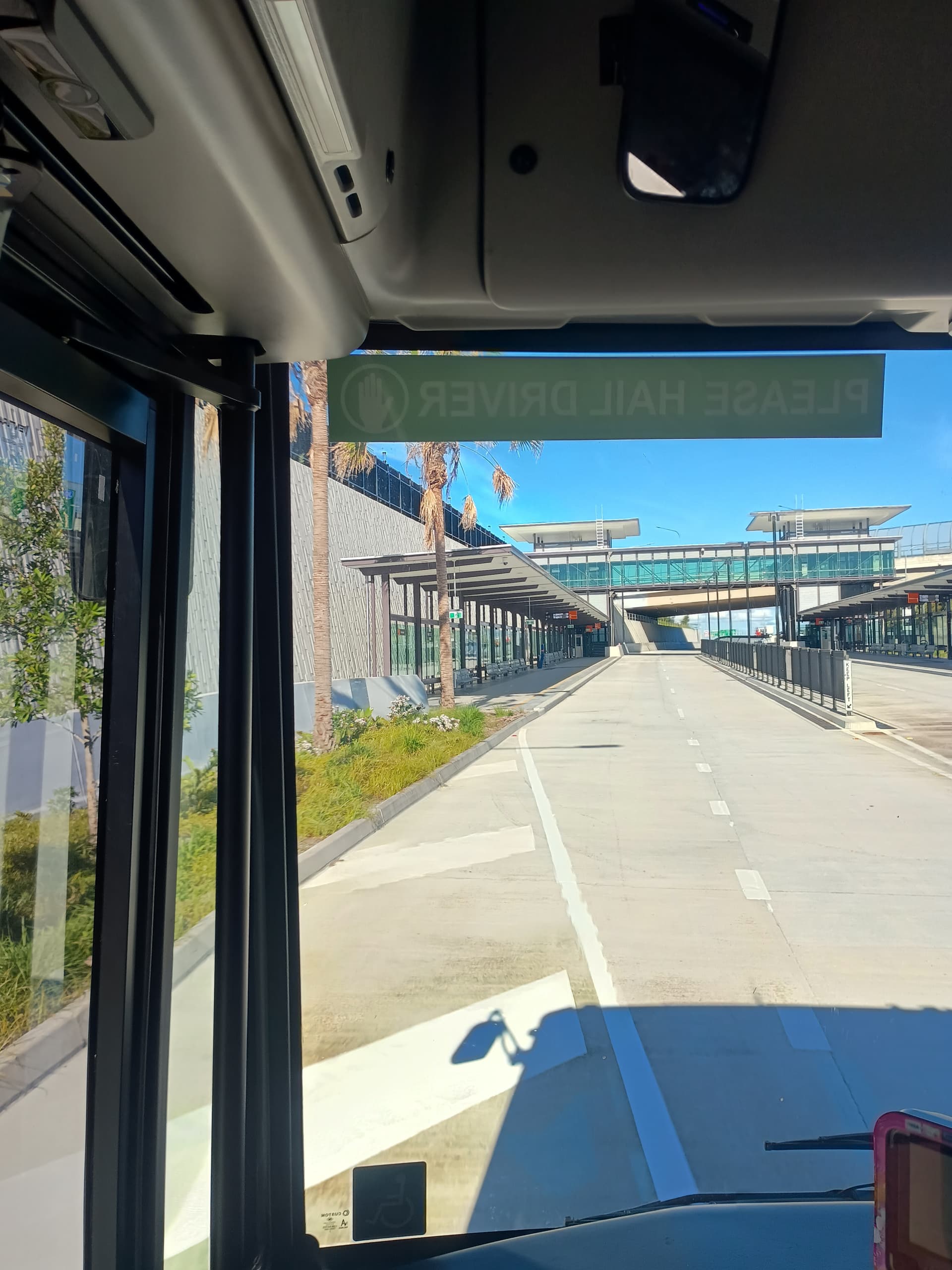
While in Brisbane we stayed quite close to the Cultural Centre bus station, and used it several times.
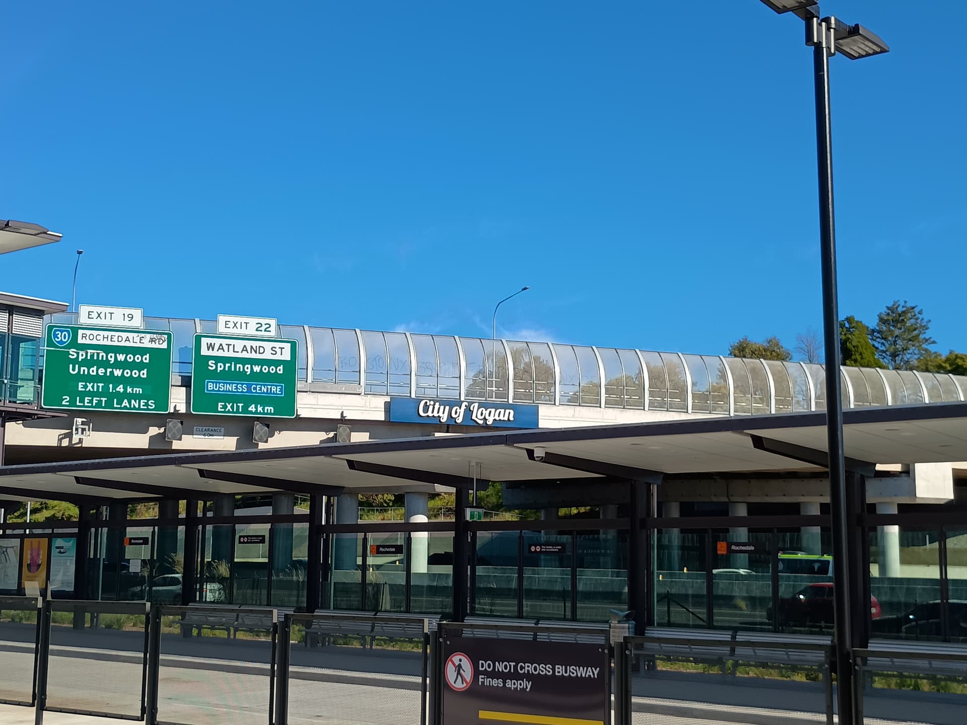
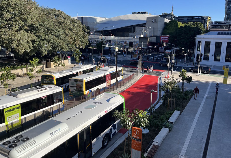
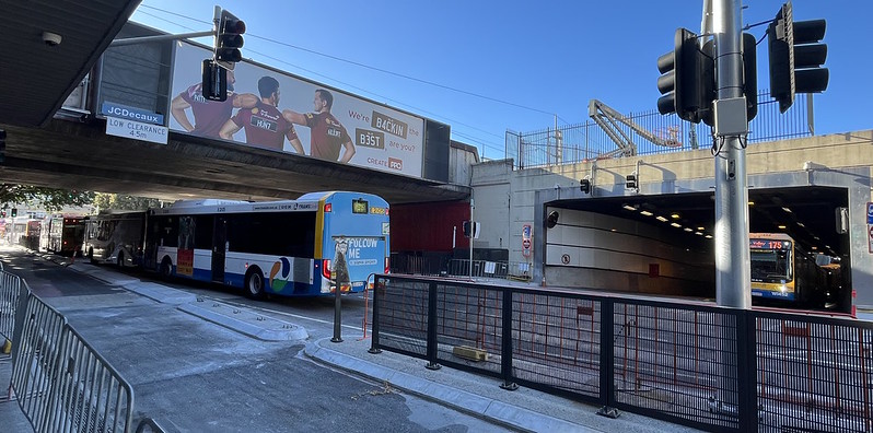
This is probably the biggest point of congestion on the busway network. Dozens of bus routes converge here heading into Brisbane CBD from the south. The stop is a kind of controlled chaos.
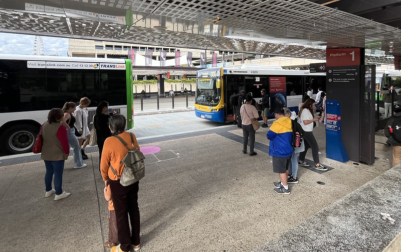
It’s got two main platforms (platform 1 for inbound, 2 for outbound), each about five buses long, and an additional smaller outbound platform 3 down the street a bit.
Bus routes that enter the nearby South East Busway use platform 2; buses for other destinations use platform 3. Because buses only have doors on the left, they have to cross lanes at the signalised intersection between the platforms.
Platform 3 is new, an attempt to reduce congestion on platform 2. This is hardly surprising – I count 50 routes that use this station.
Even over the weekend, it was congested, with resurfacing works on the adjacent Victoria Bridge (where the buses go to get to the nearby CBD) adding to the queues of buses.
We found when catching buses there during our visit that it was a bit unclear where one should wait, as several buses would arrive at once, meaning your bus could be at the front, or at the back of the pack – too far to walk down to.
As a new/occasional user, this was a bit unnerving, but waiting near the front worked – hailing the bus driver seemed wise to ensure they stopped again if they’d already stopped once at the back to let people alight.
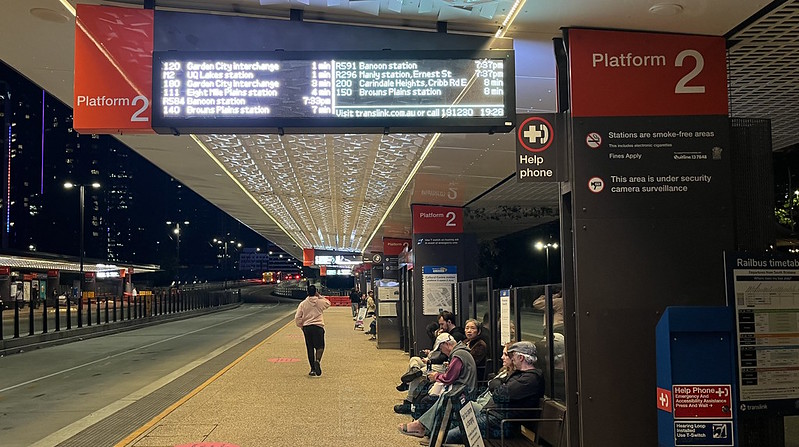
Another issue of so many routes passing through is that your bus won’t appear on the screens until it’s one of the next ten. In peak this might be only a couple of minutes before it arrives. It makes it less obvious if your bus is delayed or that it’s departing from another platform.
None of our rides had us boarding at the smaller platform 3, but on Sunday night I was passing and saw a couple confused as they watched their route 60 bus roll past platform 2 in the middle overtaking lane – I said to them “some buses go from over there” (pointing to platform 3) – they were able to run after it and catch it.
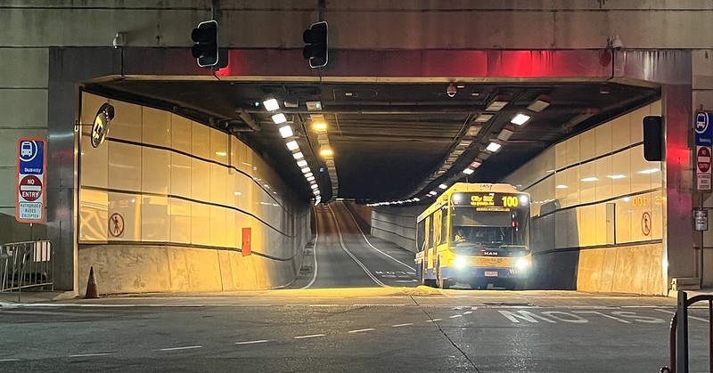
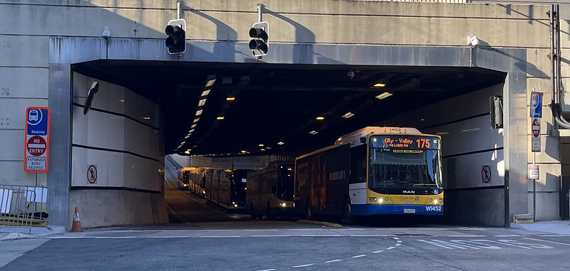
I also passed on Monday morning during peak, and watched buses queuing in the busway tunnel, waiting to get to the inbound platform 1.
No wonder there’s a big route reform package being implemented shortly to reduce the number of bus routes through here. More people will have to change routes during their journey.
Lessons for Melbourne?
I should note that Brisbane has two other things that make life easy for tourists: good quality data in Google Maps, and credit card fare payment. These are the lingua franca of public transport. With these available, it’s easy to arrive in a new city and use the network – assuming the service itself is up to scratch.
Brisbane’s busways are really interesting – you can see the potential for buses when a city invests heavily, and for the most part it seems very successful.
Could/should Melbourne do something like this?
There is a small section of busway being built along the Eastern Freeway as part of the North East Link project. But it’s likely to have only marginal effects on passenger travel times, given buses already have some priority on this section. For buses, the big problems are closer in.
Small deployments of Brisbane-style busway could be of benefit to help skip traffic bottlenecks, and avoid congestion. Around major shopping centres or on other parts of DART/Eastern Freeway routes might work well.
You probably wouldn’t build busways on a big scale like this in Melbourne – we’ve rightly gone for rail as the backbone of the PT network.
But Melbourne can certainly do much better on priority for buses.
3 Likes
Yes, The Cultural Centre is controlled chaos
1 Like
Probably worth pointing out that the lineup of buses in the tunnel looks to be just 5 buses - a LighTram, what looks to be a regular artic and 3 standard buses. In terms of bus queues, that’s a fairly minor lineup compared to the 15 strong ones I was experiencing before Platform 3 opened.
Other than that, I think that was a very good article, and it was interesting to consider how busway projects could benefit somewhere like Melbourne.
In the AM peak heading into town, they’re pushing over 200 buses per hour (bph) over the Victoria Bridge. Buses from Southbank are about 160 bph, buses coming up Melbourne St are around 35 bph and buses starting at Cultural Centre is about 30 bph. It is only surpassed by the section of busway between the Woolloongabba turn off and Allen St.
1 Like
Does anyone know where one could find information about the cost of constructing the N Busway’s tunnel section and their underground stations?
2 Likes
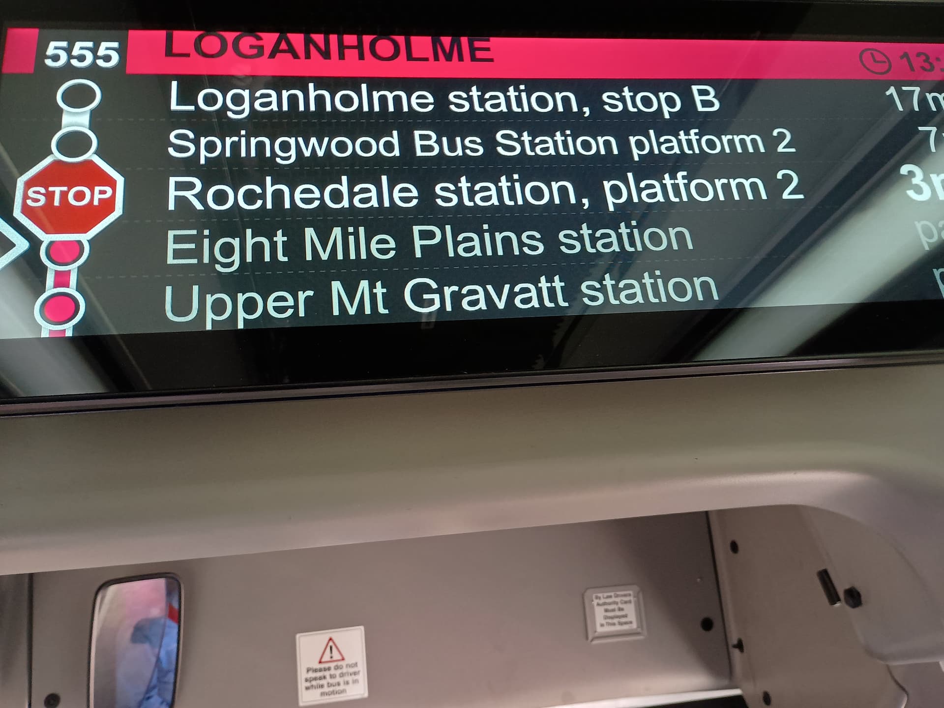
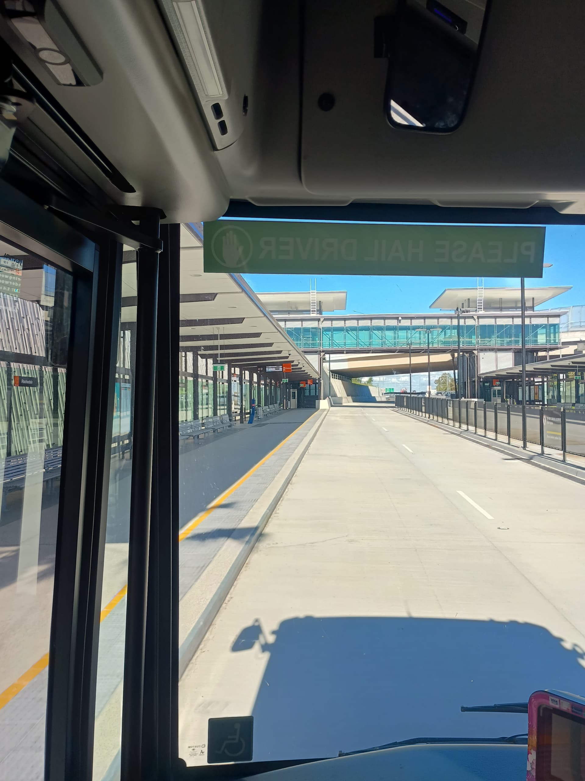
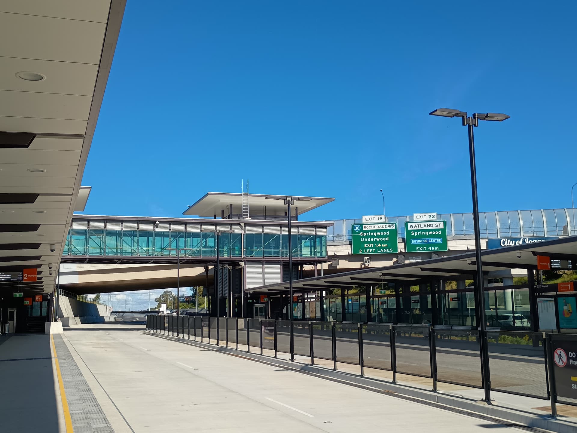
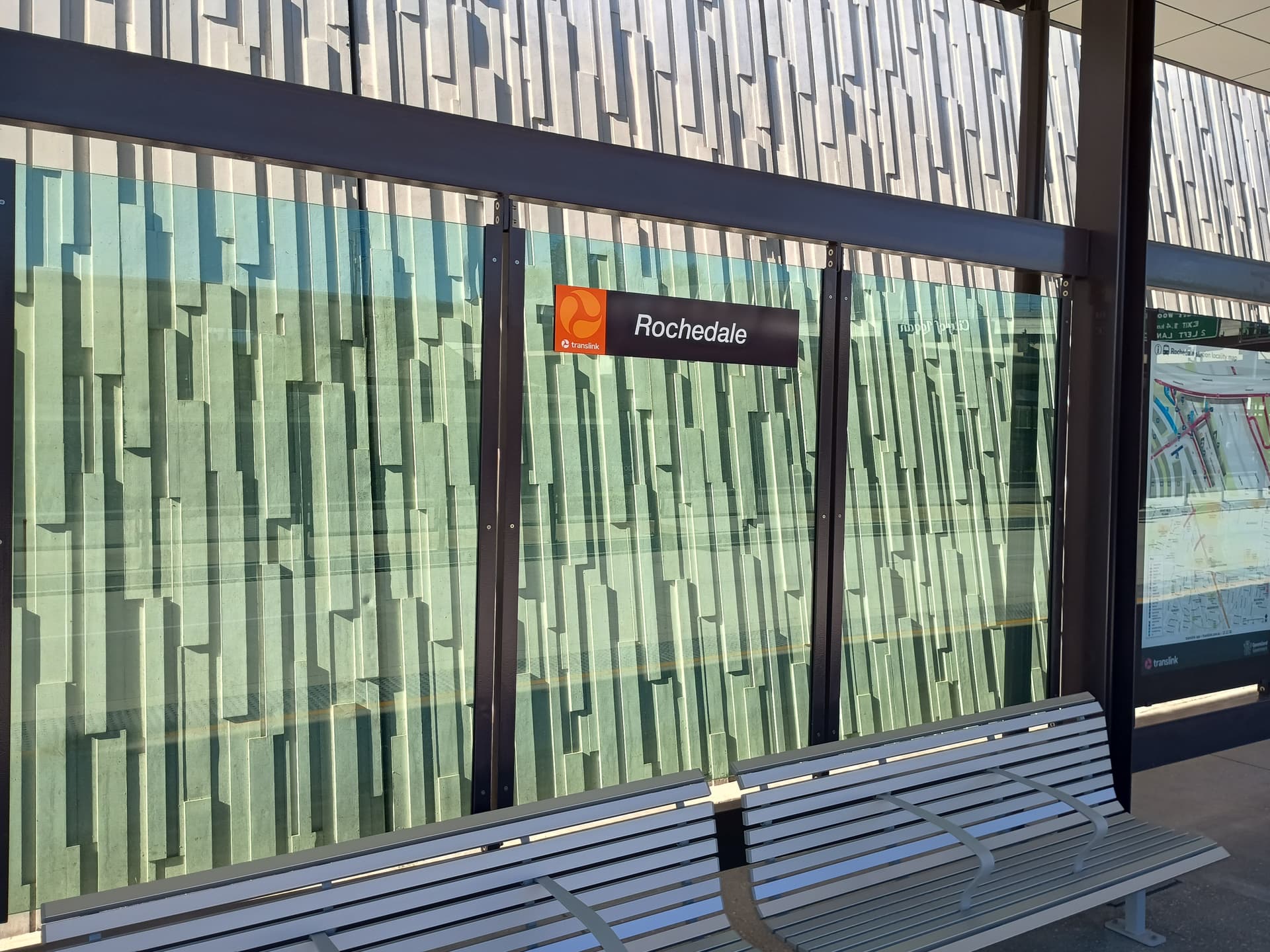
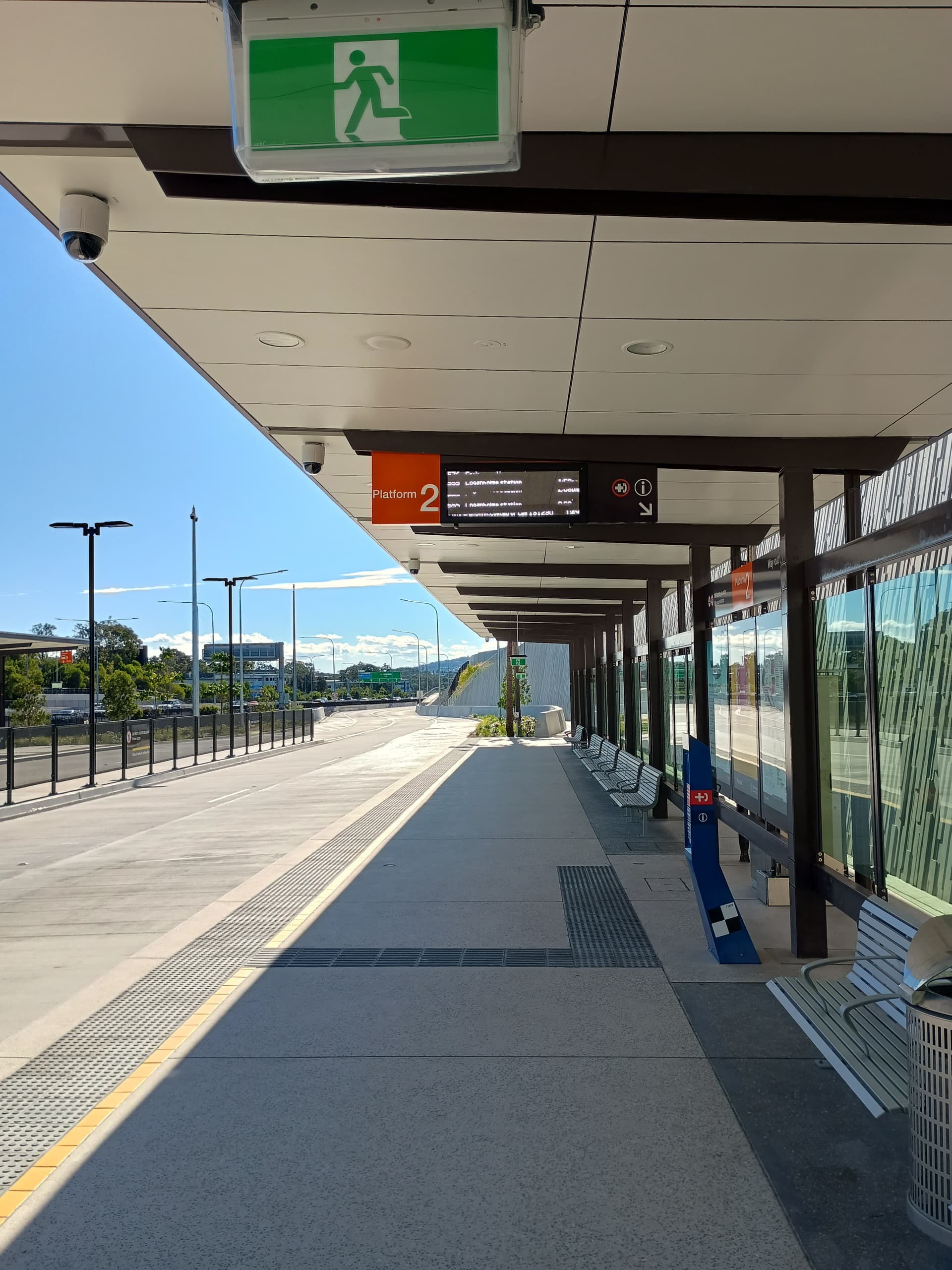
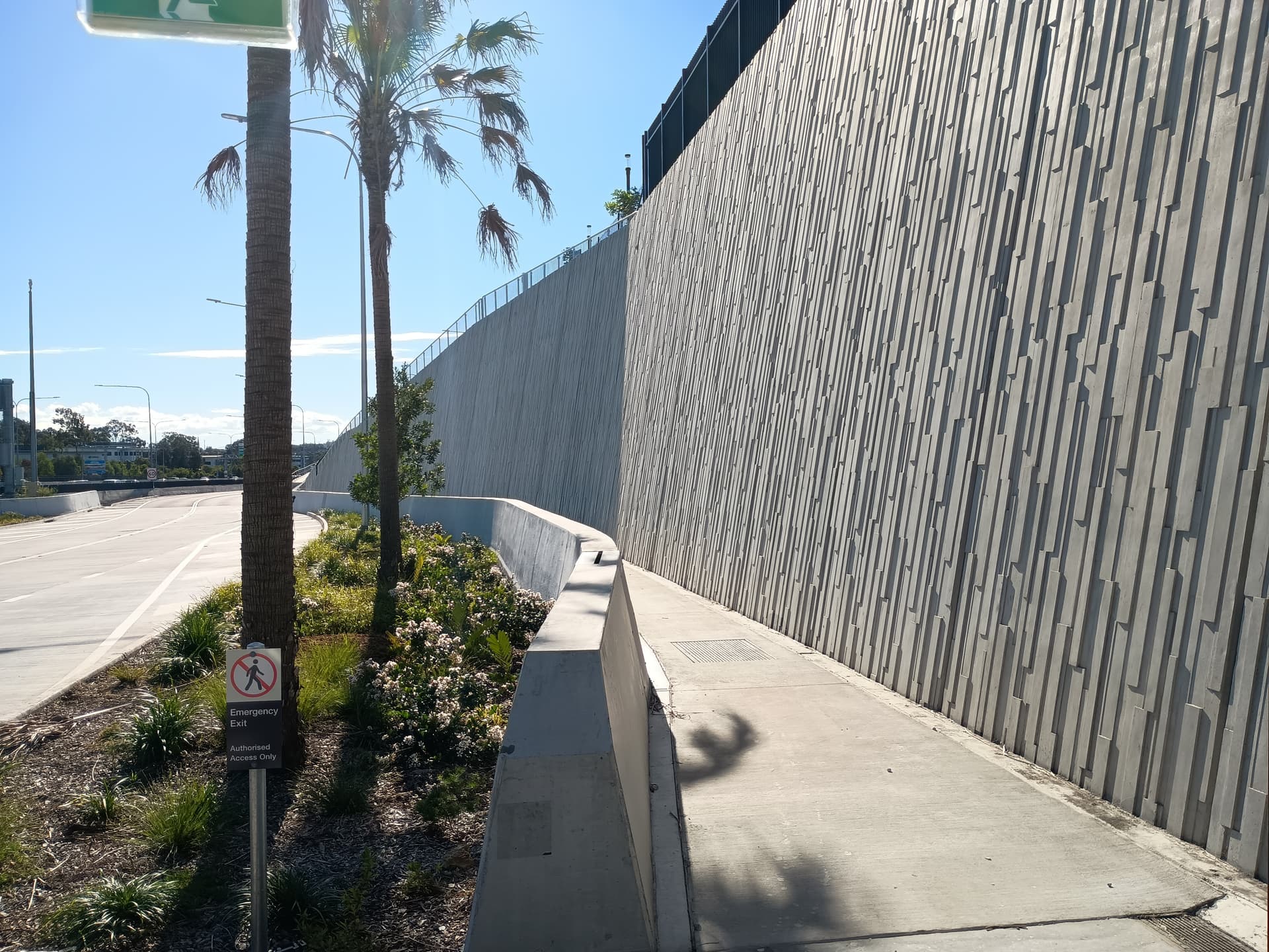
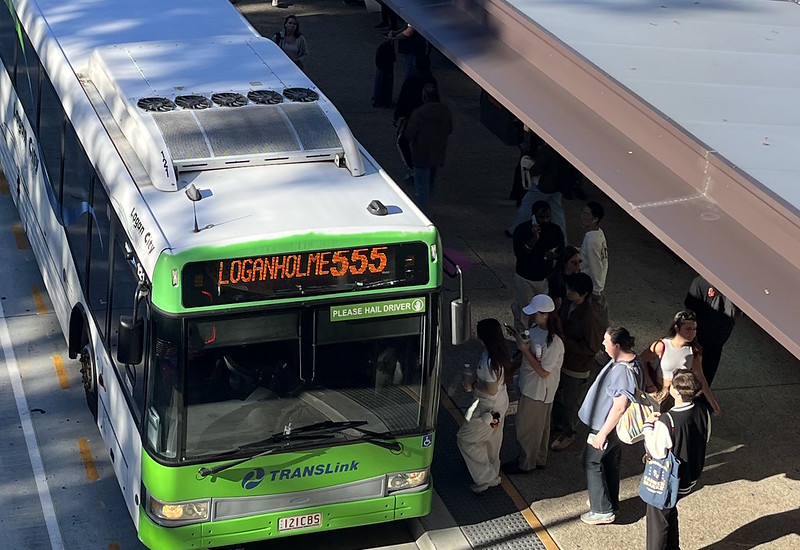
Yesterday I took the 555 on the extended SE Busway for the first time.
Does anyone know why there is such a long stretch of busway north of Rochedale Station signed 60 km/h? Further north the limits are 80 and 90 km/h (slower around stations).
If the reasoning is due to the entrance/exit of the metro depot, then why doesn’t the speed limit increase as soon as you travel beyond there?
It feels ridiculously slow as a passenger on a bus travelling on a long straight empty busway while cars in the adjacent highway are moving at 100 km/h.
7 Likes
I would also like to see more regular artics on the 555, irrespective if its peak hour or not ![]()
1 Like
555 should always be artics IMO, or at the very least from 6 am-9 pm.
2 Likes
I think the biggest reason is that the busway corridor between Rochedale and the Metro depot is extremely narrow, jammed right up against the M1 with effectively no shoulder to the road. Adding to this is that it is not dead straight either - there are some kinks in the corridor that are also a result of the corridor being so narrow and jammed up against the M1, most notably at the intersection with the old School Road (the secondary entrance to the depot back near the chargers).
3 Likes
As the great wheel of history turns back towards BRTs, the LNP is ostentatiously keen extending the “Metro” to Capalaba, which is a good thing.
Unfortunately there is zero acknowledgement by anyone that the Eastern Busway was a living, breathing possibility before being abandoned by the State government.
Who has a good summary (with some source material) about how the Eastern Busway got killed, under which Premier, and who killed it?
I’m interested because I can see a distinct possibility that politicians will “vague” their way through three years of consultation before coming up with something absolutely sub-par. Unless we’re really well equipped and know how it got killed last time, we’ll end up with a dud project and lose the chance to do something real.
(full transparency - my own preference would be 100% bus priority/right of way via as much off-road busway as is easy, and as much on-road BRT as needed, but this is genuinely about understanding how “we” lost the last round)
2 Likes
If the Eastern Busway was built, it would have flooded Cultural Centre and the Captain Cook Bridge with buses. There would have been no real ability to absorb that at the time.
So it was necessary to complete Brisbane Metro first IMHO.
Now that is more or less done, work should either proceed or they should also assess a rail option.
Assessment of a rail option is worthwhile because if the intention is to extend to Redlands, this distance is likely better handled by the heavy rail mode.
1 Like
I can’t quite follow your reasoning on that counterfactual..
But just to respond on the rail issue - yes I agree rail would be fantastic, and it should be investigated.
At the same time, I don’t think we should pass up the opportunity to deliver a strong BRT project to Capalaba given that the three major political parties (red, blue and green) all support it. To get to the kind of mode share we should be targeting (50%+) we will need both.
For better or (more likely) for worse, the timeframe of the Olympics is shaping all the public discourse about this project, and rail isn’t really feasible between now and 2032. As I said, I do strongly support a better rail connection in the east, whether via the Cleveland line or a fresh corridor.
3 Likes
How so? The Old Cleveland Road corridor already had/has a high volume of buses using it in peak, I don’t see how building ROW on the corridor will have changed that.
I believe they paused a lot of the busway extension projects after the 2011 floods. The short spur that runs to Langlands cost something obscene (close to $0.5 billion in 2011-ish dollars) so continuing the proposed tunnels along the planned corridor would be HUGELY expensive.
Given the intended timeframes, and the (un)willingness of the state government to invest in quality bus infrastructure, the best we can expect is bus jumps and T2/3 lanes until Carina. From Carina through to Capalaba there is room for adding more lanes and hopefully these will be (24/7??) bus lanes.
I’d also love for BTQ to strongly advocate for improved active transport connections to be built alongside whatever works they decide to do (i.e. protected bike lanes).
4 Likes
We all agree Cultural Centre was congested. Therefore, increasing the volume of buses, speed of them arriving, or both would have caused further congestion issues.
1 Like
Was there a plan to increase the number of buses? I don’t see why they would have needed to.
If they are/were concerned about congestion then a bus network review (a proper one) with route consolidation would resolve it.
How fast the buses arrive is irrelevant. What’s relevant is how much time is between each service.
1 Like