Finding who or when it was scrapped might be hard as I dont think it was ever funded for construction (or even final planning and design). So it is not so much a case of allocated funding being withdrawn (or a GCLR stage 4 case of reviewed and cancelled future plans) but more it was not funded in post-2011 flood budgets to progress to next stages. So it might require comparisons of budgets (and QTRIPs?) to find when funding for it stopped appearing for future years.
Infrastructure Australia have also subsequently come along and recommended the bus lanes and prioritisation approach.
… The state government today confirmed the route for the Eastern Busway from Buranda to Capalaba, to be built in stages over the next 20 years.
Construction of the first section, between the Princess Alexandra Hospital and the South-East Busway at Buranda, has already begun and is due to be completed in late 2009.
The government has committed $465.8 million for the next 2.7km section between Buranda and Main Avenue, including $123 million for 96 property resumptions.
Construction will begin by mid-2009 and finish by early 2012.
Ms Bligh today confirmed a further 256 properties would be affected on the rest of the route, either by total or partial resumption, easement, or volumetric resumption - taking land from under a property. …
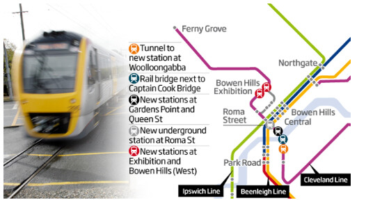
Should still embrace Newman’s GREAT idea, of putting second underground through the CBD, with a combined bus/train capability…total genius, tragically not pursued!
Wasn’t it later revealed by LNP members that the BAT Tunnel wasn’t ever a viable project?
”BRISBANE’S bold BaT Tunnel was never going to be built, former senior figures in the Newman government claim.
The two-level tunnel to carry both trains and buses under the city’s river was a centrepiece of the previous LNP government’s infrastructure plans, to be partly funded by the controversial asset-leasing program and the rest from a public-private partnership.
But even if the LNP had won January’s state election, the much vaunted $5 billion BaT project was doomed and would have been dumped during its second term in power, according to sources in the previous administration.”
Nah, BAT was the way to go, getting greater RAIL and BUS capacity through the system…but who’d be crazy enough to listen to an engineer as Premier, better to have just career political staffers, who wouldn’t know what a hammer looked like, when it comes to actual project delivery!
That project literally couldn’t be certified as safe, and did 100% nothing for northside rail capacity as trains weren’t going to be throughrouted north to south. Absolute binfire of a project (and government in general) that put this state back by at least 10 years in most fields. Good riddance.
It was about getting buses in/out of the CBD, nothing about duplicating rail services! And SO WHAT if rail and bus services are offered - SO WHAT - give people transport options!
How about we give people transport options which better cover the whole of the inner city area’s localities, taking them closer and more directly to where they want to go, rather than forcing them all through a single corridor that services only the same 3-4 stations. I want buses to go through South Bank, I want buses that go over the Captain Cook Bridge and service Elizabeth Street, Edward Street and Alice Street, I want (more) buses that go up Kangaroo Point and over the Story Bridge straight to Fortitude Valley, and I want more buses that go up and service Spring Hill.
You don’t see all of Sydney’s bus routes, tram lines, train lines and metro following the exact same corridor as one another. They deviate from one another, they run a few blocks apart, etc.
Thinking more about this Eastern Busway proposal, the corridor is probably best built as Priority A Busway from the beginning.
An interim solution is only sensible if it is significantly cheaper and the period that interim solution lasts for is medium term.
However, what we know from the Gympie Road Transit lane is that $172 million was spent for just 2.3 km of Priority B transitway or $74.8 million/km.
You may as well spend a bit more and do Priority A, which is actually what is needed along this corridor. Rather than spend a lot of money doing Priority B surface transitway, then that going over capacity, and then having to pay for Priority A busway anyway.
The other thing that needs to be looked at is the choice of mode. If the intention is to build the line out to and beyond Capalaba (e.g. long distance), heavy rail extending off the Cleveland line might be the better mode.
Areas of a carriageway within the SCR corridor that do not cater for through traffic (that is, they are used solely for parking) are not considered traffic lanes and maintenance of these areas is the responsibility of Local Government.
So to the extent that this isn’t an issue out east, you’d see class B costs reduce compared to class A. Then again, if it is an issue we’ll see exactly what we saw on Gympie Rd.
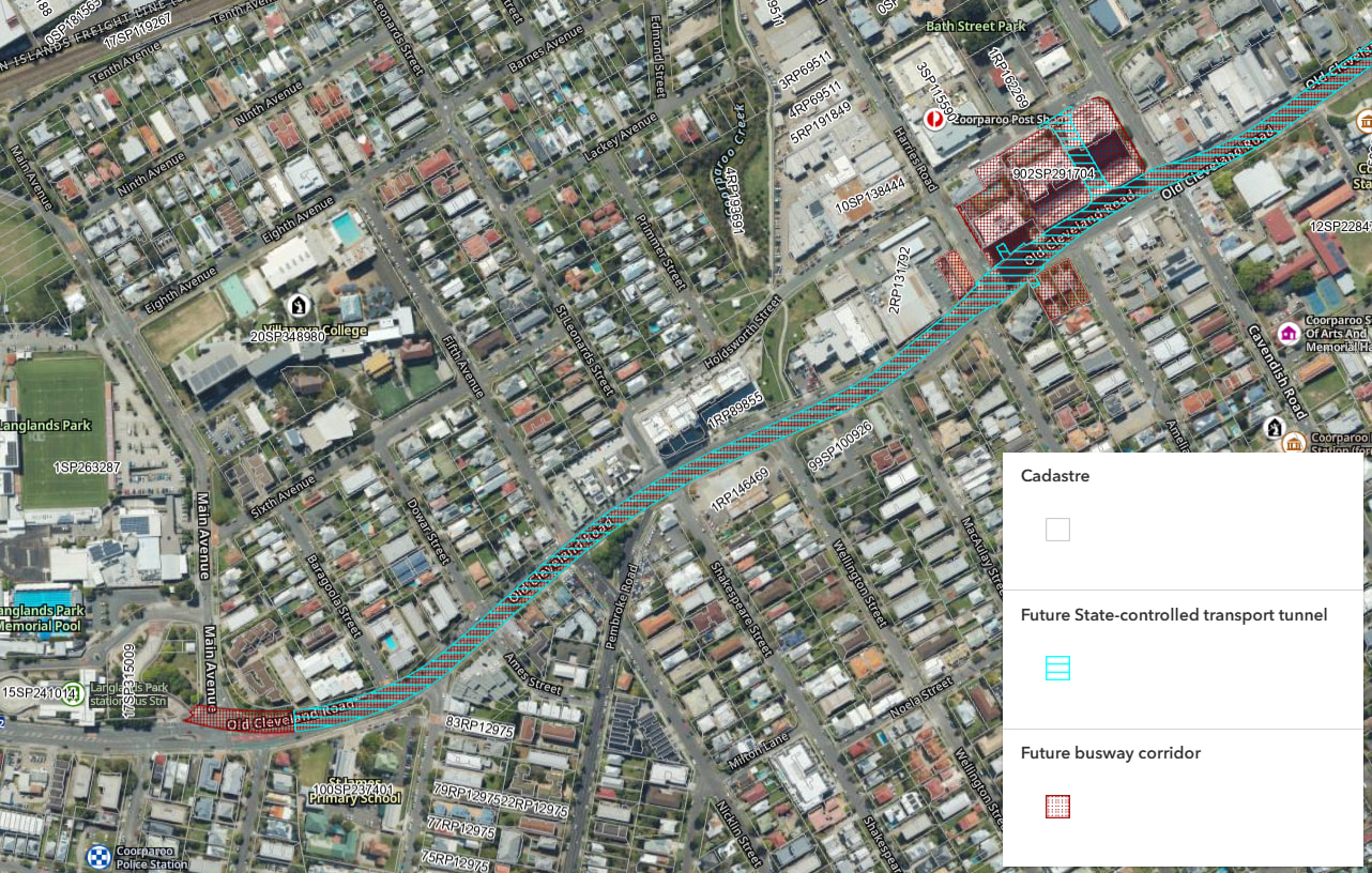
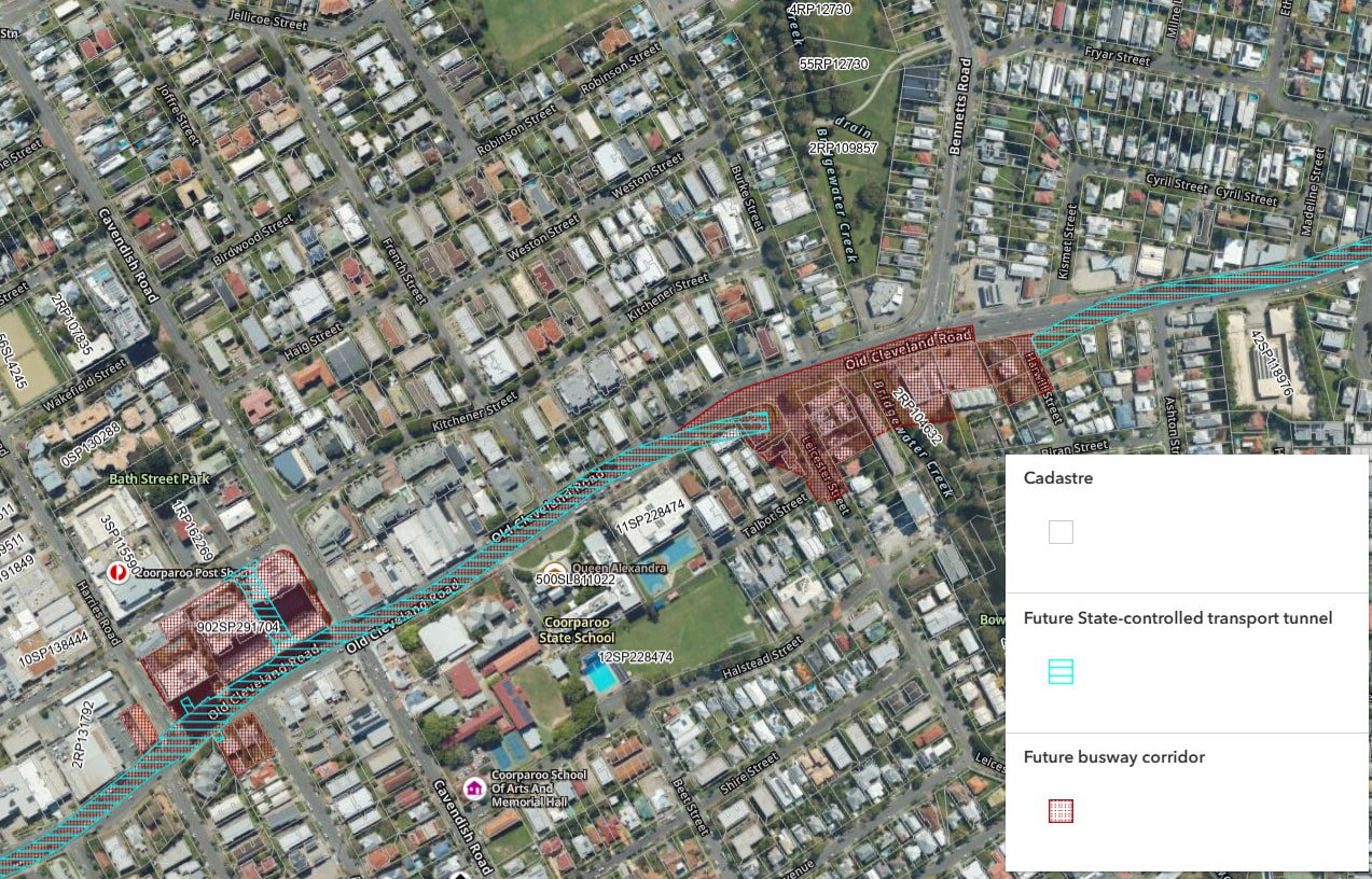
In 2011, the Eastern Busway between the SEB and Main Ave (incl. Stones Corner and Langlands Park stations) cost $465.8 million. Any busway extension is going to be exorbitant, particularly because the next bit (Leister Street / Bennets Road) has a reasonably constrained tunnel corridor, plus the station at Coorparoo Square is also pretty complex and constrained.
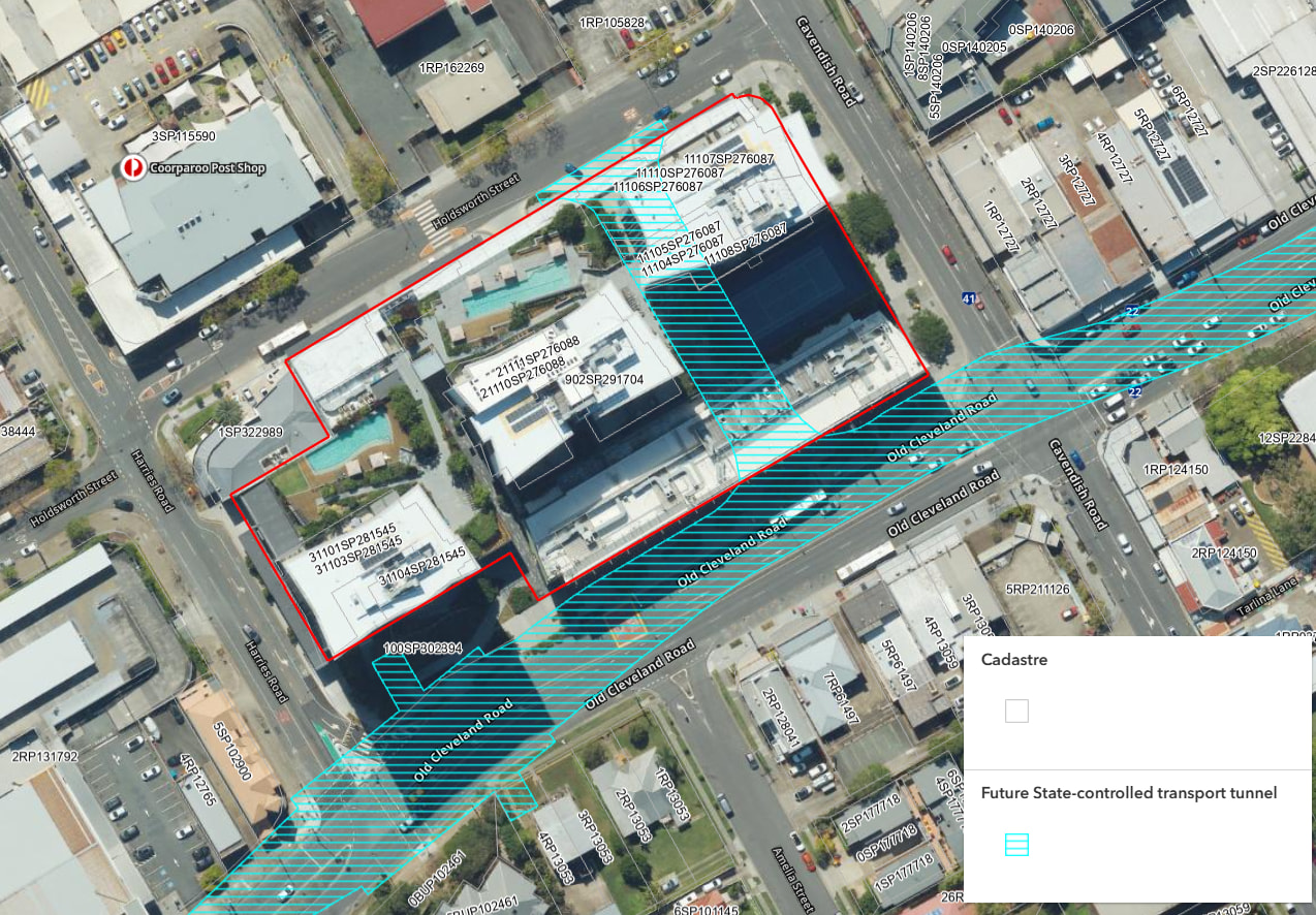
Coorparoo Square is designed around the gazetted busway alignment. The busway access tunnel is built into the carpark and is within a volumetric easement. The station itself is under the road, and has entrances located on the vacant parcel in front of Coorparoo Square on and land to be acquired on the other side of the road.
I can’t screenshot the plans at a scale that makes any sense and leaves the annotations legible, but the ‘Plans Final Part 1’ document on this Development Approval shows both the volumetric easement, the future busway access provision and the land dedicated for the future station. Application documents A004256686 | Development.i
The 2 existing tunnels are cut and cover, at ~200m and ~100m in length. The next tunnel is 1.5km long and most likely will need to be driven.
For comparison, the Adelaide Street tunnel is 250m and was said to cost $500 million.
Add in the Coorparoo Square station, the transition and culvert over Bridgewater Creek (and maybe a station at Bennetts Road) and we’re looking at a a very big number, just to get to Bennetts Road.