Whatever is happening to the 777 will have an impact as I expect that will still be shown.
I also don’t expect a new Gold Coast network map until the bus changes happen.
Whatever is happening to the 777 will have an impact as I expect that will still be shown.
I also don’t expect a new Gold Coast network map until the bus changes happen.
Yeah I’ve been told bus changes are expected to be executed on the 24th of August alongside a reshuffle of shifts across all Kinetic Surfside depots.
Noticed the new map released today no longer has the airport symbol as the station dots, instead the airport symbol now sits near the word “International”, “Domestic” or next to the label for Gold Coast Airport for the 777 bus route.
Makes sense - they have T5 in the donut now.
International and Domestic terminals will soon be renamed once terminal 3 gets built. Construction commences in the next financial year (based on insider information)
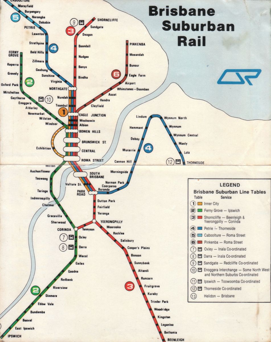
So this isn’t the first time we have numbered our lines
Question for Millenials & older: Do you remember in (?) 2007 to 2012 (?) there was a QR network map displayed in the trains alongside the ordinary one?
This map included all the proposed rail extensions, including proposed opening dates. I recall the Maroochydore line was due to open in (?) 2029 which at that point seemed impossibly far away.
Does anyone know how we could get hold if it?
There were billboard versions put up in a few prominent spots as well - one on Robina Town Centre Drive at the rail overpass heading east, another one I think at the Petrie commuter car park.
I thought it was earlier than that, but I distinctly remember the Varsity Lakes and Elanora extensions being listed as under construction and by DATE (can’t recall, but maybe 2015?) respectively.
Have you tried the internet archive?
Going back to this: got full confirmation for Monday 7th of September. Ignore what I said before.
There was train line numbers back in the 80s i think…
There were, on the system map in the timetable book (covering all suburban and interurban lines; cost 50 cents) that my father got in the mid-eighties. However, those numbers didn’t seem to be used apart from that rail map, for some reason.
That’s probably the same map the timetable book had! Or at least similar; it didn’t show a thin line down the middle of any of the lines (which were mostly electric by 1984–85 anyway).
[Edited to add:] But you never saw references to, say, “Line 3” on the individual foldable paper timetables, or the boards at Central. Instead it was always “Beenleigh Line”.
Not sure what you mean by this, but I’ve definitely done some searching!
The Internet Archive: https://archive.org/