I don’t recall any substantial bush fires around the campus in recent times, but I do recall reports of smaller fires occurring around the Mt Gravatt Reserve and occasionally around the campus as well (there was a somewhat significant grass fire at some point, I seem to recall).
I have a feeling that Griffith University undertake controlled burns around the properties to keep the fuel load down.
Griffith University does a reasonable amount of bushfire preparation and mitigation. They have small bushfire units on site at Nathan and Mount Gravatt. There was a controlled burn at Nathan just on the weekend.
The plans extending to essentially closing campus on extreme and catastrophic fire danger days. Bit hard to do that for a high density residential development…
We have developed specific actions on extreme and catastrophic fire danger days to minimise the numbers of staff on affected campuses. This may include closing a specific campus on catastrophic fire danger days, asking staff and students to work and study from home and deliver learning and teaching activities remotely.
All to say that risk is not determined by whether an event has happened before or not, but there are clear signs that a significant enough risk exists to warrant a range of actions. These are more feasible for a managed facility and ‘population’ like a university versus thousands of residents.
The other problem with building a TOD at the old Mt Gravatt campus is that despite being very close to the station, there is a VERY steep hill to walk up from the station to the campus proper. If you weren’t a uni student with no other option, most people would find this a pretty big barrier to easily accessing the station from their place of residence
Yeah and unfortunately those places don’t often see a lot of walk up catchment or TOD. Whereas flatter areas like Woolloongabba, Chermside, Stones Corner, Newstead, South Bank etc is where you’re seeing a lot of the density going. It just makes it much more ripe for walkability/active transport.
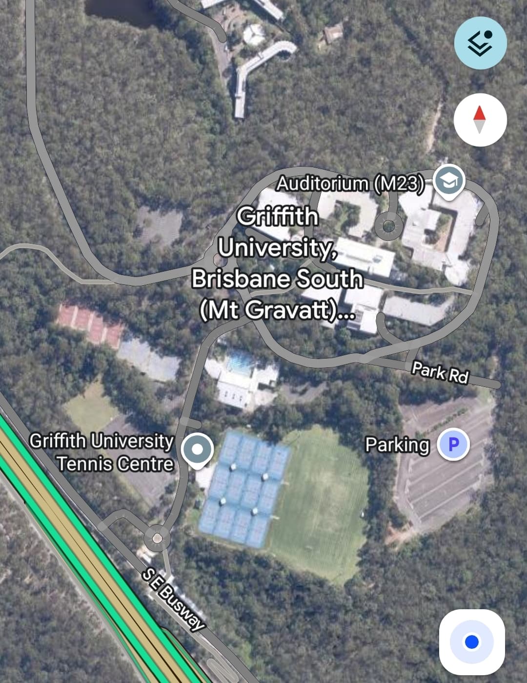
The existing sporting fields, car parks and tennis courts are on the same level as the busway so would be better options - but still very close to bush so I imagine setbacks/ buffers would constrain the sites a lot. If they did that though the existing buildings would then be better off demolished and turned to nature park/greenspace.
It might not be all of the site, but the flatter part closer to the busway could be better for TOD. The remainder could be converted to offices or community spaces (e.g. library, recreation).
So often we hear that we can’t have housing because the infrastructure isn’t there - this is a case of where the infrastructure is there and the housing needs to follow.
I think this video would be relevant to this discussion:
Could we have a series of parallel roads that follow the contour lines of the topography? So that the hill is spread out over a longer distance? I wouldn’t be entirely sure on the exact way you would do this, but maybe having roads parallel to Circular Drive could help, since it somewhat follows the contour lines (emphasis on the somewhat here, it still does look quite steep)
To be honest, unless a similar campus-style use can be secured for the site, I would prefer to see it just demolished and revegetated. I don’t feel it is a location suitable for high density residential - it is a very isolated location separate from the wider suburb, it only has a single road in or out, and sits between the two important areas of bushland Toohey Forest and Mount Gravatt Outlook Reserve.
Probably worth noting as well that the passenger set down area for the bus station (the roundabout at the end of Sports Road) appears to be no longer accessible by private vehicles - I’m pretty certain that it was annexed for the bus turnabout.
Honestly fair enough, it would also be nice to have a station servicing a good area for walking tracks, and Toohey Forest is quite a pretty forest pretty close to the CBD, which is valuable
A fun fact I just discovered about Mount Gravatt Campus - the heritage listed private school Yarranlea Primary School is located right in the middle of it, and they are eyeing off some of the uni campus land when it closes.
Primary school eyes Griffith University site ahead of closure
*By Catherine Strohfeldt
An independent primary school hedged in by Griffith’s Mount Gravatt campus is keen to leverage closure of the university site to expand, as other stakeholders also eye off the swathe of government-owned land.
Yarranlea Primary School reopened as a mixed-age independent school in 2014, having previously been a state school closed by the Newman government.
Adrienne Innes, legal director of the school’s board, told ABC Radio Yarranlea had 60 students but was unable to expand “because we can’t build another classroom”.*
They aren’t going to close the station - it is still the Busway station that best services Griffith’s primary Nathan Campus, it was only just fitted out with a turnabout to serve as the terminus for a number of southern Brisbane and Logan bus services (112, 115, 123, 135, 155, 161, 177, 545, 554, 576 & 578), and it is the main interchange location between core busway routes and Mains Road routes - you get a reasonable number of people from the 130 & 140 getting off there and backtracking to Garden City (I do the same myself to get between Loganholme and my partner’s place off Mains Road).