I’m wondering if this means our trains will become T1, T2, T3 etc…
[whistles like he knows nothing at all]
2 Likes
 Now I AM intrigued…
Translink still somehow doesn’t have an official release yet (go figure) so I’m expecting a major announcement then.
Can’t wait for them to go round and do up every map on the whole network…
Official line numbers make way more sense than just vague destinations especially on lines like the GC where the final stop isn’t even what’s listed
3 Likes
Until then I’m going to pick numbers and then get irrationally angry when they don’t match
Ipswich<->SC should be T1
Springfield<->Redcliffe T2
GC<->airport T3
Beenleigh<->ferny grove T4
Cleveland<->shornclife T5
Roma<->doomben T6
1 Like
At risk of thread derailment:
Aiport T1
Gold Coast T2
Beenleigh T3
Ferny Grove T4
Cleveland T5
Shorncliffe T6
Redcliffe T7
Springfield T8
Ipswich T9
Nambour T10.
Tried to align each line with the platform it uses at Roma Street.
1 Like
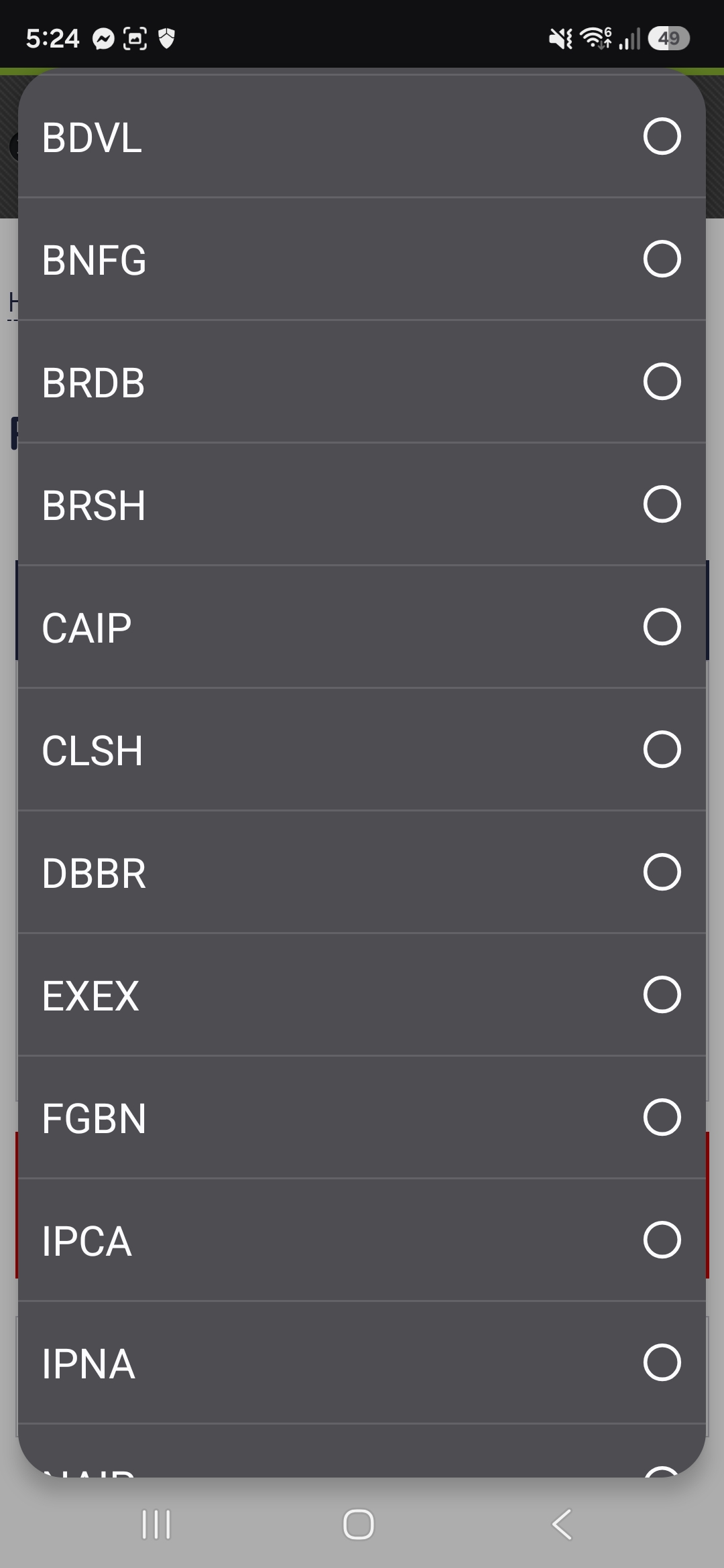
Just so we’re all clear, assuming train line numbering ever happens, we’re going to back it. I have personally come around on this one purely because of all the VLDB CASP IPRP BS.
8 Likes
What? Don’t you love having train runs like CACA?
That one definitely tells you what to expect on a train closure.
They’re talking out of their arse. There’s no L2 on the system feed at all.
4 Likes
BRBR a personal favourite 
1 Like
If I was numbering the network for trains, I would work backwards from the final post cross River rail network.
You’d want to keep the Beenleigh and Gold Coast lines adjacent numbers. You’d want to keep Ipswich and Springfield as adjacent numbers. You’d want to keep the Doomben number adjacent to the Ipswich and Springfield numbers. And you’d want to keep the Cleveland line adjacent to Beenleigh and Gold Coast.
You’d probably want to make the airport line T1 in the end state so it’s nice and easy for visitors. A greater proportion of patronage is on the southern part of the network so you’d want those numbers to stay the same.
So you’d end up with today:
T1 - Ipswich - Nambour
T2 - Kippa Ring - Springfield
T3 - Doomben
T4 - Cleveland - Shorncliffe
T5 - Varsity Lake - Airport
T6 - Beenleigh - Ferny Grove
3 Likes
You want to have the same line number from one end to the other - otherwise you have a train going from Gold Coast to the airport changing its line number in the CBD. So many people in Brisbane don’t realise that trains keep going through the CBD, and you end up with weird scenarios where people who live at shornclife don’t realise their train continues through the CBD to Boggo Road where they can connect to UQ ( for example). It is critical that people view the network as end to end lines.
5 Likes
This. We already have names for the branch lines.
And for that reason I don’t think it is worth it to number the lines until after CRR service patterns start coming online. In that way, T1 undoubtedly should be the north-south spine (Gold Coast - DSC), with the rest (T2 - Kippa Ring - Beenleigh/Helensvale etc) to follow on that pattern.
On the contrary - you want to get all the big information-presentation changes frontloaded so that when CRR opens, the only thing that’s different is the lines on the map, and what the pairings are.
2 Likes
Also terms like SHCL, CLSH, FGBN, BNFG, RPIP don’t even imply that the trains are going to travel the full length of their designated line:
- SHCL: Nortgate - Cannon Hill/Manly
- FGBN: Ferny Grove - Coopers Plains/Kuraby
- RPIP: Kippa-Ring - Milton
Admins, can you please merge this post to a different thread, since the topic of train service codes doesn’t align with Gold Coast Light rail?
3 Likes
How do Sydney arrange their T numbering and would how they do it work up here ?
That doesn’t bother me so much, T-numbering would also abstract over short workings. This is because Real Life Passengers will do things like not catch the Coopers Plains service from the city to Yeronga, because Yeronga is on the Beenleigh line.
Back in 2013 there were 7 lines:
| 2013 Number | 2013 Lines | Description |
|---|---|---|
| T1 | North Shore, Northern and Western lines | Berowra via Waitara, Hornsby via ECRL, Epping via Strathfield, Richmond via Strathfield, Emu Plains via Strathfield |
| T2 | Airport & East Hills, Inner West & South lines | Glenfield (& Macarthur?) via Clyde, Macarthur via East Hills, Airport/Sydenham. City Loop. |
| T3 | Bankstown Line | Lidcome & Liverpool via Bankstown. City Loop. |
| T4 | Eastern Suburbs & Illawarra Line | - |
| T5 | Cumberland Line | Schofields - Liverpool - Campbelltown |
| T6 | Carlingford Line | shuttle to Clyde |
| T7 | Olympic Park | - |
Map, of sorts: Transit Maps: Technical Review: New Sydney Trains Network Map
Since then:
- 2017 the T2 is now Leppington & Parramatta - Clyde - City Loop. Macarthur via East Hills and Airport/Sydenham to City Loop now the T8.
- 2019 the T9 splits out of the T1, following Epping-Chatswood going over to Metro.
- 2020 the Carlingford line closes for LRT conversion
- 2024 Sydenham-Bankstown closes for Metro conversion. T3 now Liverpool - Regents Park - Lidcombe - City Loop. T6 now Lidcome-Bankstown.
As for up here: I would expect one line number per colour on the map, and for the south/west lines to keep numbers and especially colours post CRR (i.e. Gold Coast stays gold). I’d also expect lines in the same post-CRR sector to have adjacent numbers. I don’t have an opinion/expectation on which line gets to be T1.
I’m expecting the lines to be numbered according to their Roma Street platform IMO.
I wonder if we’ll see anything rumoured in the new maps - nothing has emerged yet with new network maps for tomorrow
1 Like
Meanwhile there are other passengers who want to go past Coopers Plains, Kuraby, Northgate, Milton, etc. For someone living in Boondall waiting for the next train at South Bank station, they would see the trains coded as CLSH or BNSH and think the train goes all the way to Shorncliffe station, only to feel the disappointment for the train actually only going as far as Northgate. In fact, I feel like the codes showing the line’s proper terminus (e.g. Cleveland - Northgate as CLSH) is more misleading for people who want to go beyond Northgate station on the Shorncliffe line.
I feel like the biggest cue for the trains going to the passenger’s desired destination is the colour-coding of the train lines. In your ‘not catching the Coopers Plains train to Yeronga’ example, that could be taken as 'passengers not catching the “Coopers Plains” destoed trains since the PID and train’s desto board only display ‘Coopers Plains’ instead of ‘Beenleigh’. However, people going for stations before Coopers Plains understand the train is going on the Beenleigh line since the PIDs colour code the FGBN colour coding as red.
1 Like